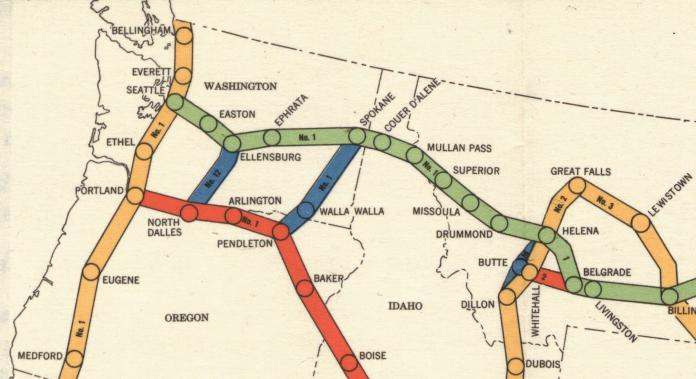
Civil Airways in 1940, NW United States.
Here is a map of the entire US.
In the era of the DC-3, a color and a number identified
Civil Airways in the US. East-West airways were Green or Red and North-South
airways were Amber or Blue, as seen in the map above. Appropriate legs of
four-course radio ranges established these airways.
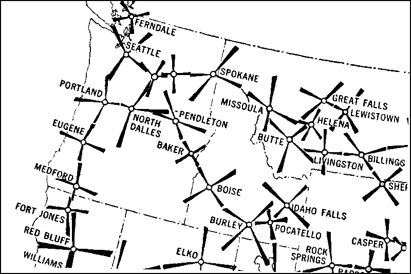
Here are the Radio Range
Stations in the NW United States in 1940. These stations transmitted signals
on four separate courses, hence the name "Four-Course Radio Range." You can
see that the "interconnection" of the legs of adjacent stations form an
Airway.
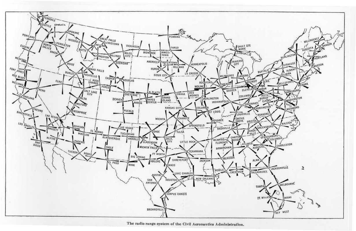
Here you can see a map of the
entire US. To download a high resolution version click
here.
Now, thanks to Mark Thomas, DC3-338, we can fly these Civil Airways in a
fashion similar to the early days of navigation. Mark has recreated almost
the entire 1940 US Civil Airways system with a network of VORs and airports.
The download file includes five files and a Readme file
Amber Airway ... 90 Flights
Blue Airway ... 42 Flights
Green Airway ... 86 Flights
Red Airway ... 86 Flights
A sortable Flight Table indexing the 304 Flights, with Altitude info.
The simple Airways routing eliminates the need for FSN Flight Plans.
Note the "Revised Altitudes" link at the top of this page. Altitude data was
verified by actual flights for 104 routes, mostly in the mountainous
regions. Another 120 or so were verified by other means, and the rest were
"Educated Guesses" ... some of which may need adjustments. Click the
altitude link for the latest altitude information. If you find that a
suggested altitude is not correct or optimum, please Email us and we will
update the Flight Table. Check the version number of the Altitude link to be
certain that your information is current.
While the Flight-Information tables are simple, it is important that you
read the Readme file for a brief explanation on how to fly these routes. And
be sure to enhance your experience of flying these Civil Airways by loading
Real Weather.
Thanks again to Mark Thomas for this fine effort.